Planfeld

Planfeld Product page

Planfeld is an web-based application for optimizing planning, tracking and reporting of health interventions activities in the field.

It is an easy to use tool that removes all the technical details, making it easy for users to use all the advanced Analytics and geospatial data to generate robust plans, monitor field interventions, and make improved decisions in near real-time.

more

Background

»Make better decisions in health delivery.«

Communities in developing countries could have better healthcare when providers can make data-driven decisions. GIS data is crucial in delivering health systems strengthening interventions. When planning an intervention, knowing the lay of the land and coverage areas will determine how much ground one would be able to cover.

Health workers are required to visit every settlement location and vaccinate all eligible children during polio immunization campaigns, for example.

Several factors pose challenges to reaching every settlement. Settlement lists that do not correlate to each other on state and local level, volatile security situations, logistics challenges and the fact that missed settlements are not reported timely leaves a large number of settlements missed at the end of the campaigns.

There is a need to create new ways of improving the use of geodata for optimising, planning and monitoring because of the time and resources that can be lost in these projects.

Plan a campaign

»Plan. Monitor. Evaluate.«

PlanFeld makes all aspects of field logistics easier for all types of field activities, including large-scale data collection exercises and health service delivery.

The planner provides a simple, visual way to organize campaigns and intervention field activities around target location, resources and exercise schedule. Planner makes it easy to define campaigns by leveraging the power of existing geospatial data and algorithms to optimize resources across the span of coverage and activities planned for the campaign. It ensures efficient allocation and deployment of available resources.

Planfeld lets you choose from various campaign templates
Define Target Locations
Define Target Population

After campaign configuration, which lets the user play around with variables like team sizes, campaign days, settlements to be covered, and various catchment criterias, planfeld automatically generates a detailed session plan.

The plan provides a comprehensive list of all settlements and the population that can be reached per team and per day.

Generated plan for a micronutrient survey.
Plan shows movement of various teams between local areas.

Monitor a campaign

»Verify coverage in real-time.«

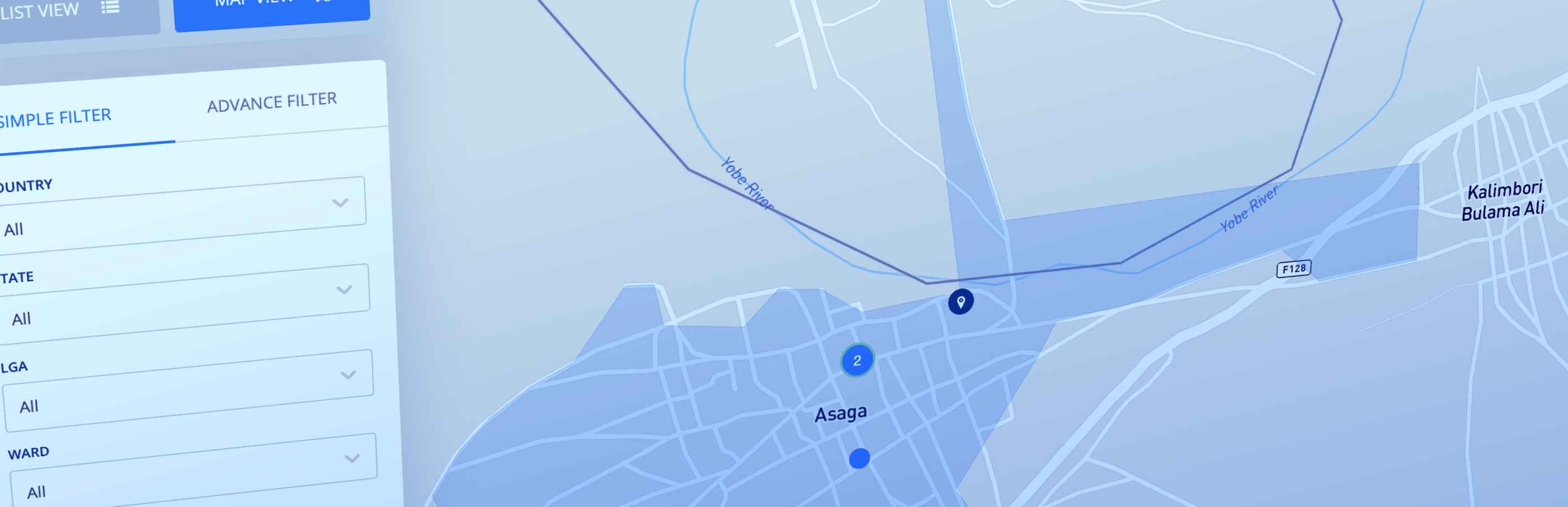
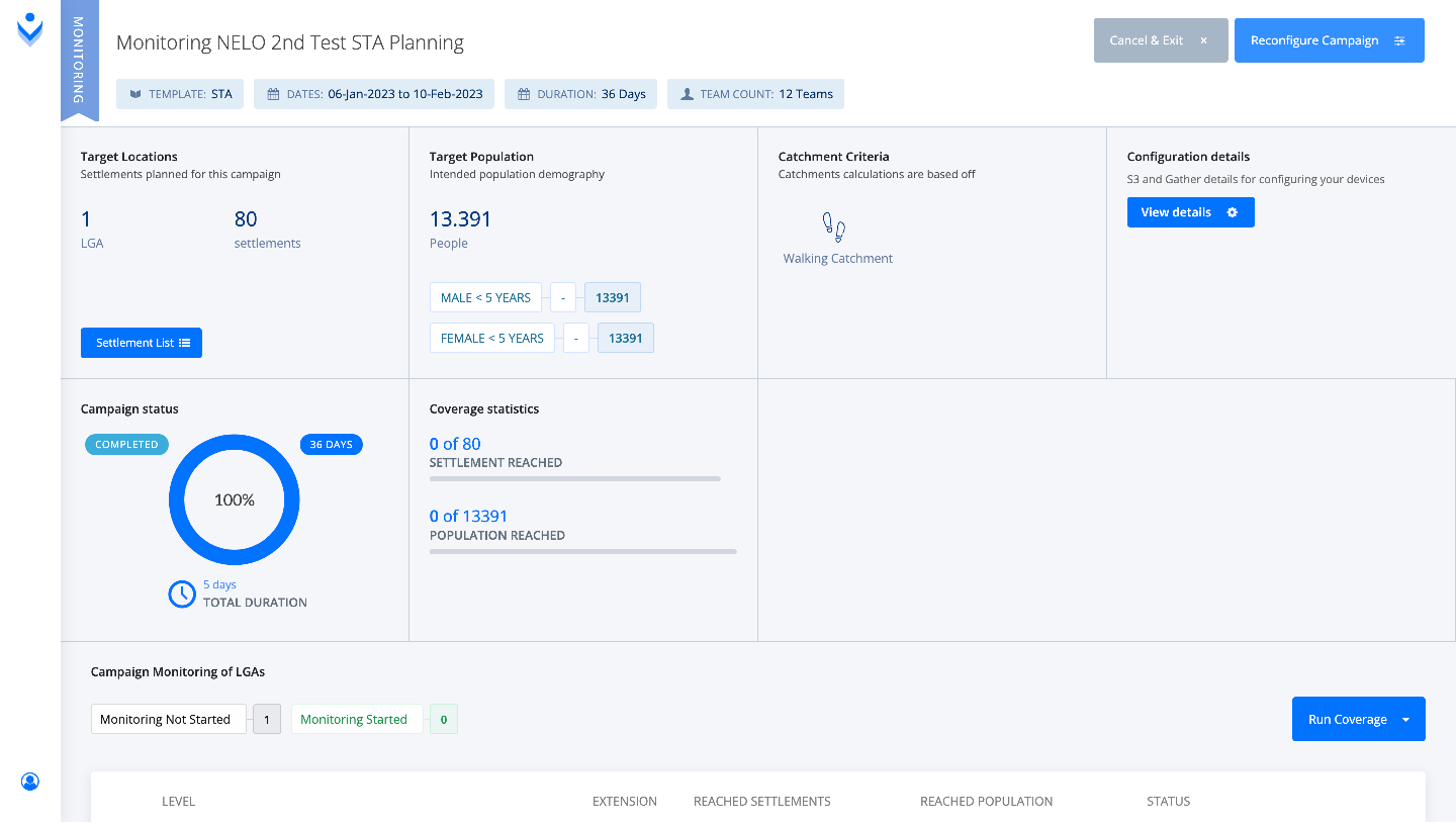
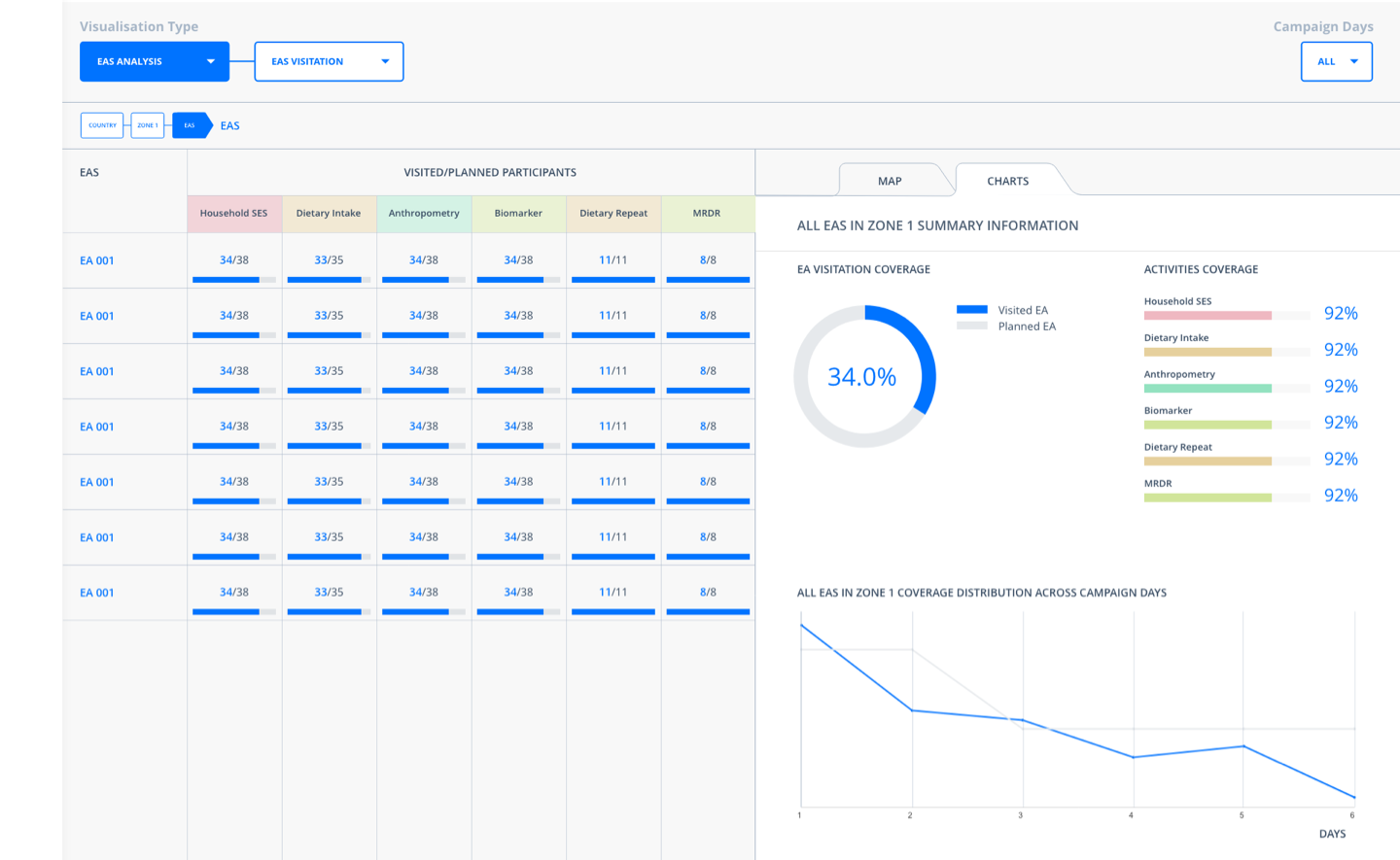
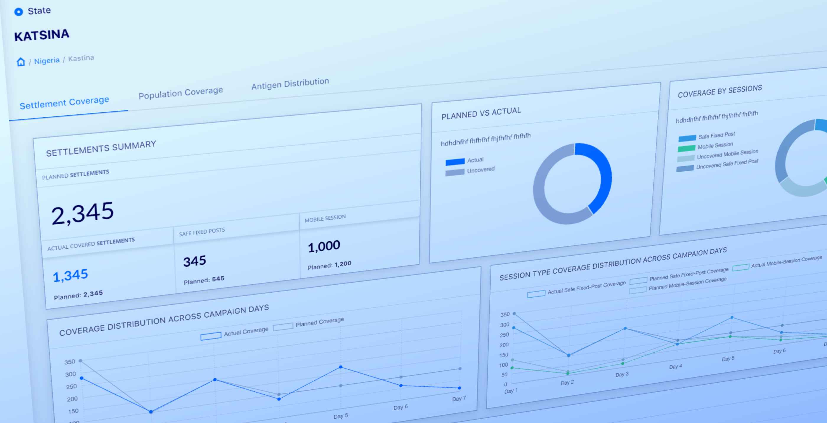
Ensuring that the field intervention is on track is easier with the Monitor module on Planfeld. Using GPS coordinates, users can verify visitations and service delivery of their field teams and see coverage progress near-real-time on maps and charts.

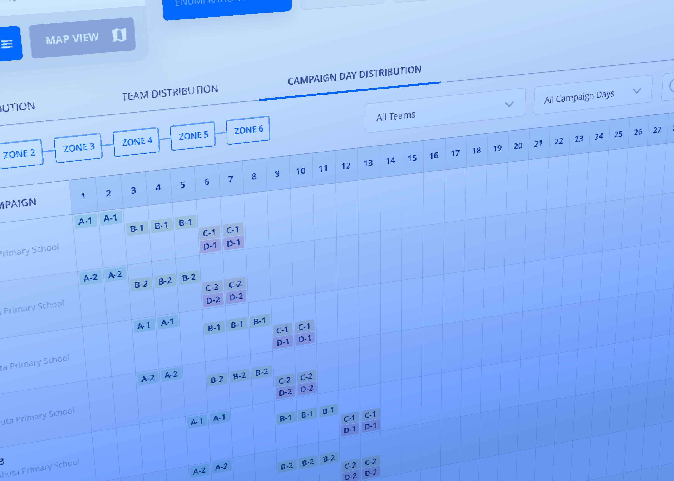
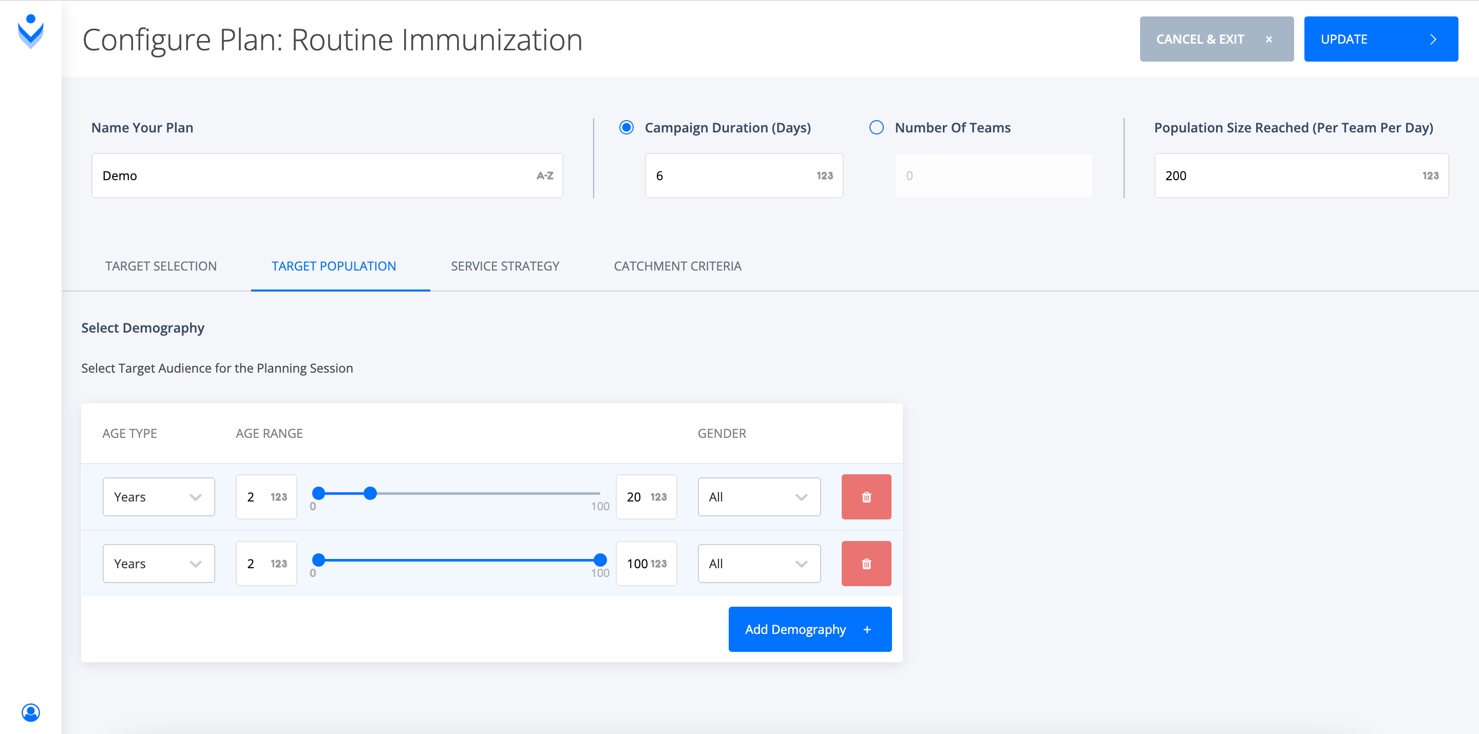
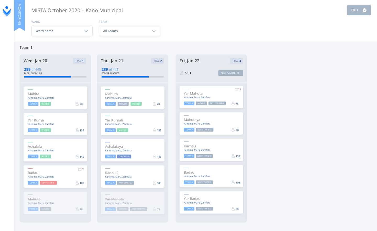
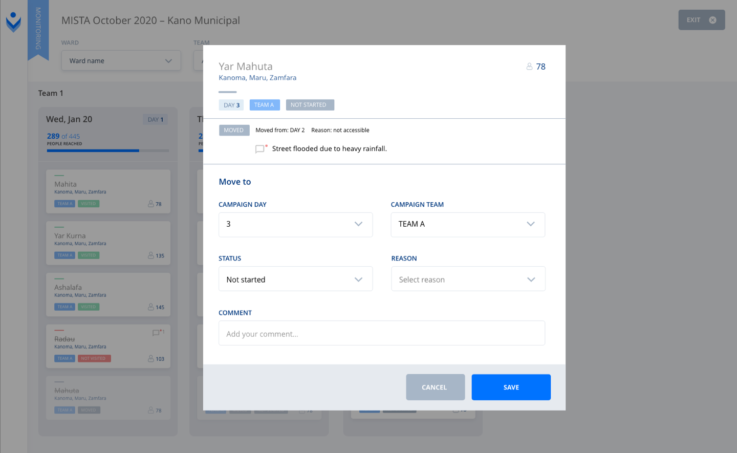
As part of the solution, we developed a tool to support dynamic planning, enabling changes in daily implementation plans due to fluctuating security situations and logistics challenges to be incorporated into the daily monitoring of settlement visits.

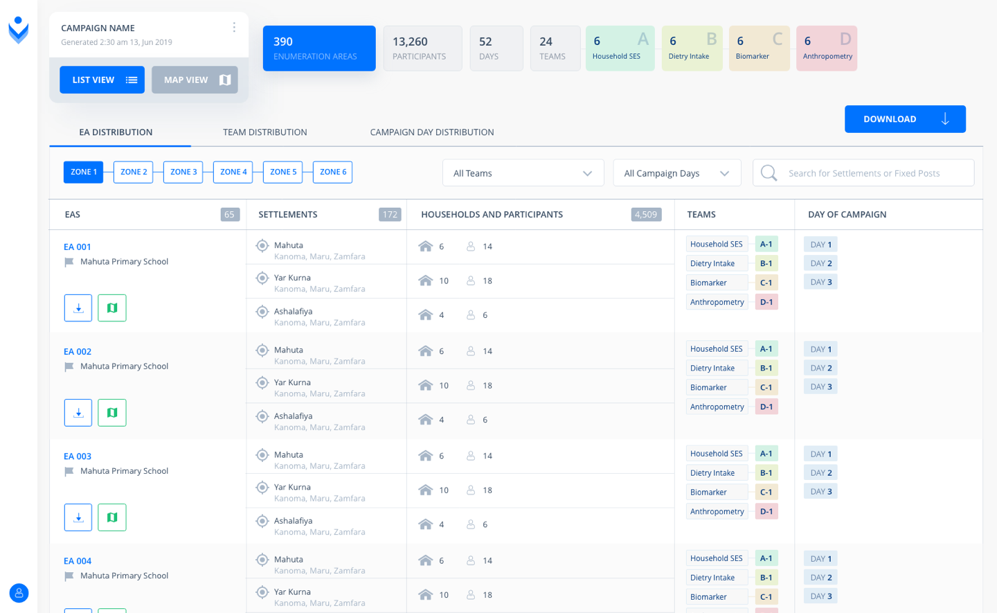
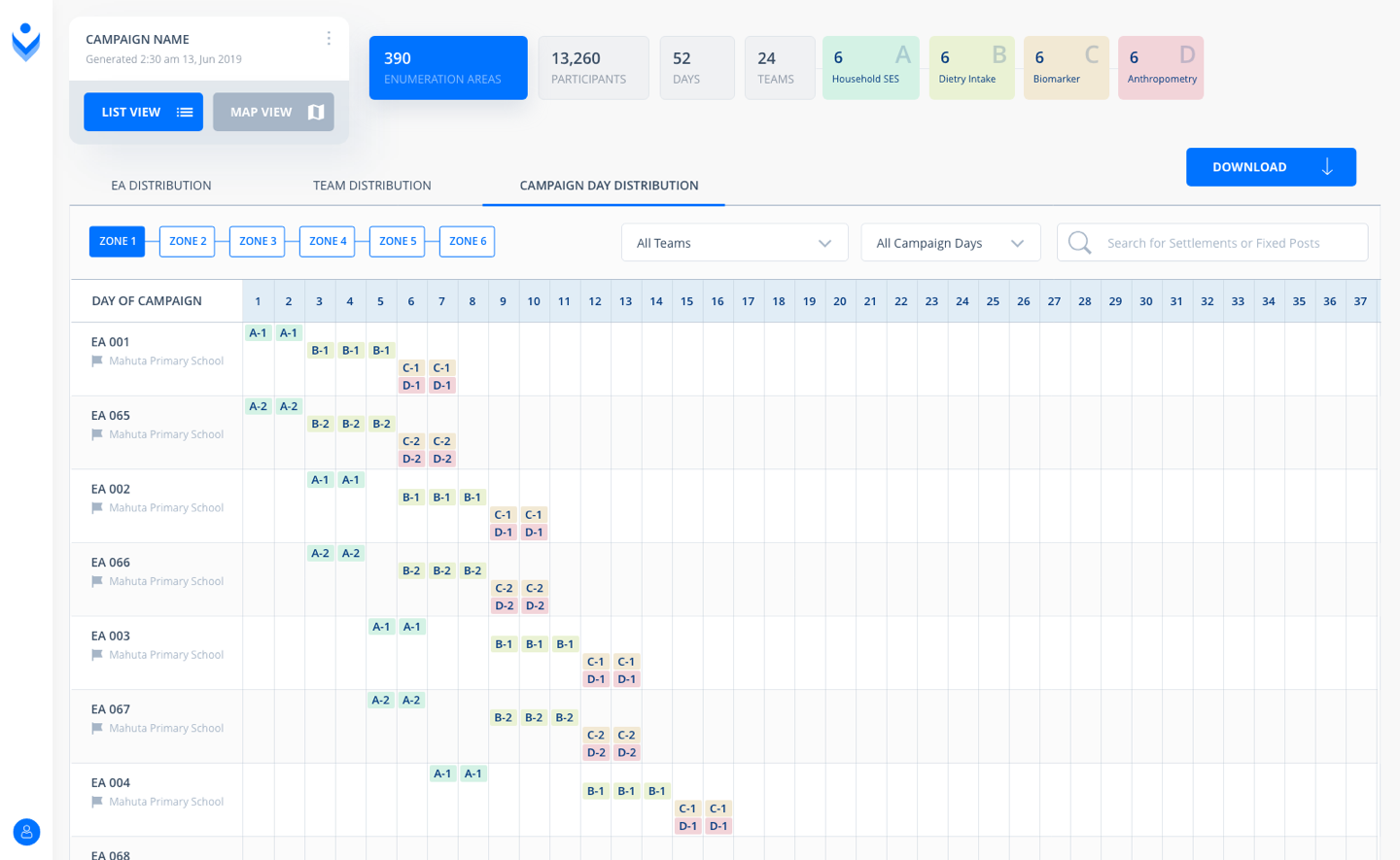
The tool analyzes and compares GPS coordinates from mobile devices carried by vaccination teams against those of settlements on the daily implementation plan. It generates a map and list of settlements visited or missed on a daily basis. This supports field consultants at the daily review meetings and finally enables them to aid the teams to plan visits to missed settlements on subsequent days prior to the final mop up day.

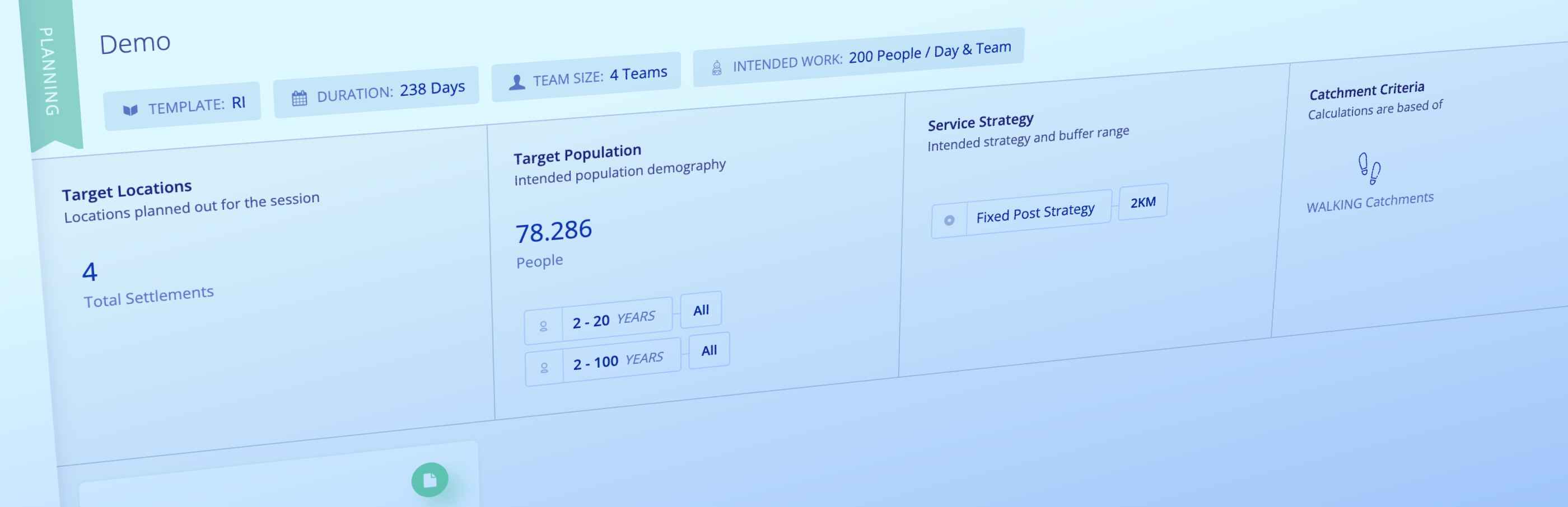
Finally, Planfeld measures the performance of each field activity with its reporting and visualization templates. Users can define indicators to assess performance and get insightful analytics into outcomes of planning and monitoring field activities.

Overview of a campaign
Planned versus visited Settlements on a Board
Adjust plan after daily review of visitations
Resolving Geodata mismatches
Analysis of micronutrient survey campaign

Outcome

»Improved Tracking and Accountability.«

Planfeld Product page:
Leveraging the power of geolocation data & intelligence for the enhancement of field campaigns.

Case Study by Planfeld:
Seasonal Malaria Chemoprevention Campaign

1%

Proportion of settlements missed
(has significantly reduced from 22% to 1%)

49%

Proportion of missed settlements resolved before the end of campaign
(increased from 8% to 49%)

back